CSP’s Miranda Gray, Luke Zachmann, and Brett Dickson use new, cutting edge technologies to estimate and map risk of large fire in forested and woodland ecosystems of the West.
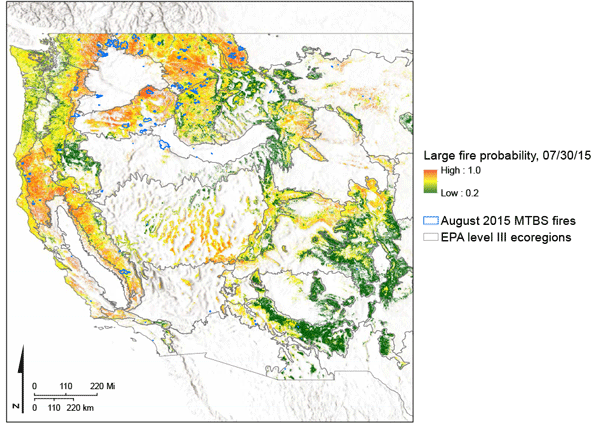
There is broad consensus that wildfire activity is likely to increase in western US forests and woodlands over the next century. Therefore, spatial predictions of the potential for large wildfires have immediate and growing relevance to near- and long-term research, planning, and management objectives. Fuels, climate, weather, and the landscape all exert controls on wildfire occurrence and spread, but the dynamics of these controls vary from daily to decadal timescales. Accurate spatial predictions of large wildfires should therefore strive to integrate across these variables and timescales. Here, we describe a high spatial resolution dataset (250m pixel) of the probability of large wildfires ( > 405ha) across forests and woodlands in the contiguous western US, from 2005 to the present. The dataset is automatically updated on a weekly basis using Google Earth Engine and a continuous integration pipeline. The results can provide operational fire managers with contemporary, on-the-ground information to closely monitor the changing potential for large wildfire occurrence and spread.