In collaboration with scientists from the USGS, CSP staff helped to develop a decision support framework for amphibian management, using boreal toads as a case study, across the Southern Rocky Mountains Region (SRMR). The team created a habitat occupancy model incorporating threats like disease and hydrological changes, based on novel metrics describing drying patterns of > 150 historical breeding sites in the SRMR and derived from > 30 years of Landsat imagery. This model forms the basis of a new web-based tool and information dashboard that allows managers to assess tradeoffs between disease, fire risk, and habitat suitability. The web tool provides probabilities of occupancy, colonization, and extinction for boreal toads and amphibian chytrid fungus under current and future conditions at multiple spatial scales, along with spatial information on current fire risk and hydrological changes at the watershed level.
Explore the data and capabilities of the tool through the Boreal Toad Dashboard. The accompanying technical report can be found here.
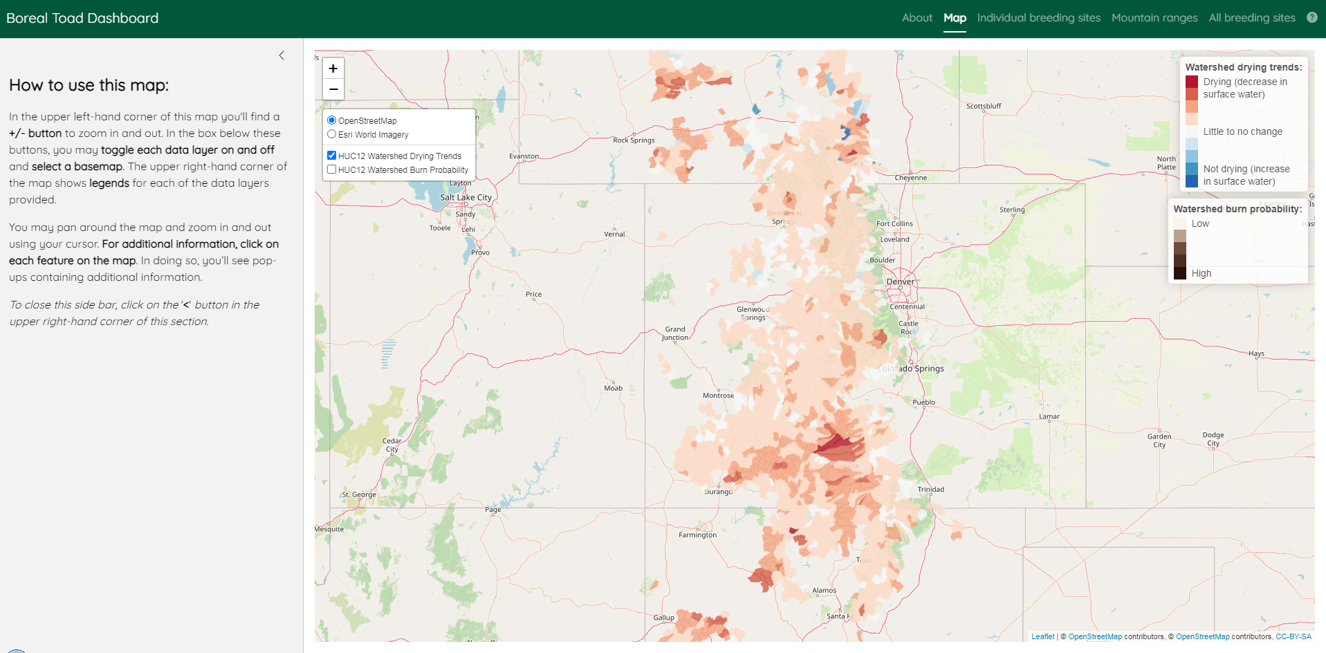
Screenshot of the Map tab in the Boreal Toad Dashboard. The Boreal Toad Dashboard is a decision-support tool that allows researchers to explore current and future occupancy trends of the boreal toad and amphibian chytrid fungus at breeding sites throughout the Southern Rocky Mountains. In the Map tab, users can explore site level occupancy probabilities, historical and future wetland drying trends, as well as current drying trends and burn probability for watersheds suitable for boreal toads. Note that site-level data are not displayed here as they are considered sensitive data, but are available to toad managers from state and federal agencies (e.g., Colorado Parks and Wildlife, U.S. Forest Service) in a password protected version of the dashboard. In other tabs, users can explore graphs of occupancy and colonization trends for individual breeding sites, mountain ranges, and the Southern Rocky Mountains as a whole. Image and text: USGS.