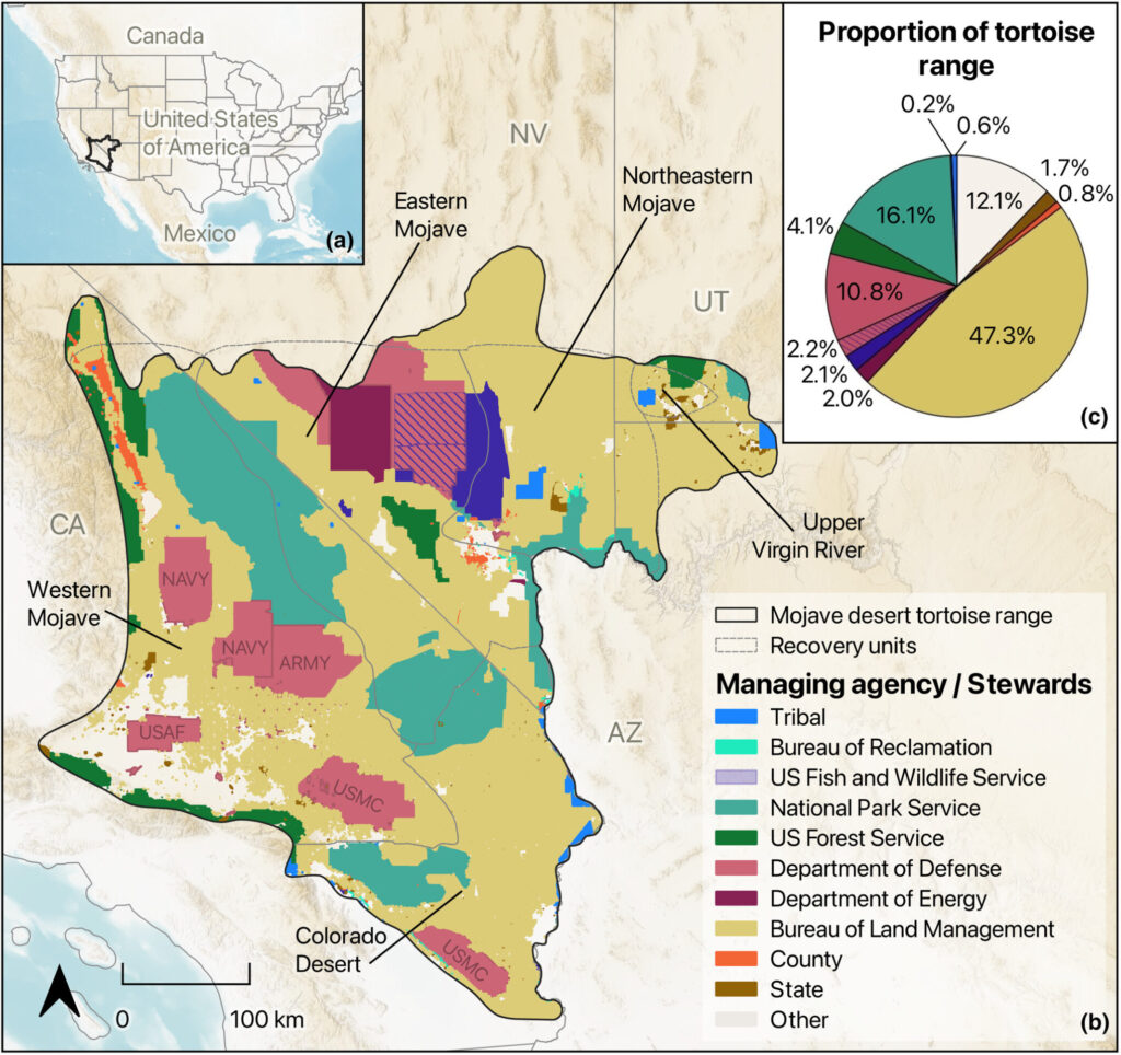
A new paper by Grimm et al. aims to address knowledge gaps around stressors on Mojave desert tortoise populations and how perceptions vary across agencies, by region, and over time. By working with managers from multiple jurisdictions, we co-produced a concise, updated list of what managers believe are priority stressors affecting tortoise populations where they work, identified actions used to address these stressors, and learned about constraints to implementing these approaches. By focusing on only the top priority stressors, our co-produced list provides a tractable set of stressors on which to focus management approaches and support the creation of decision support tools targeting managers’ greatest concerns. Given that prioritized stressors can change over time, our results provide a contemporary snapshot of priority stressors to ensure that current management approaches and recovery actions target the greatest concerns, within and across the many jurisdictions encompassed by the range of the Mojave desert tortoise (see image below).
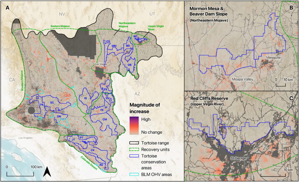
Relatedly, another new paper by Robillard et al. sought to better model and map how off-highway vehicle (OHV) route networks have evolved in the Mojave Desert ecoregion, with implications for understanding how this potential stressor impacts Mojave desert tortoise populations over time and space. We developed a novel machine learning (computer vision) approach and used high-resolution aerial imagery from 1970 to 2022 to estimate OHV route density across the range of the tortoise and at multiple time steps. Specifically, we trained our computer vision model to recognize specific linear features as OHV routes, which include non-paved designated routes, washes in the presence of other non-paved routes, and primitive trails similar in width and geometry to traditional OHV routes. We then used our model predictions to investigate whether OHV route density has increased across the tortoise’s range over the last 50 years. Finally, to identify management priority areas with high degradation risk, we calculated the percent area within a variety of management areas, including Bureau of Land Management Areas of Critical Environmental Concern, among other protected areas and federal recovery units. Our results suggest that OHV activity increased across key protected areas and units between 1980 and 2020, representing the first-of-its-kind effort to quantify and map OHV route expansion with broad spatial coverage and at a multidecadal resolution (see image below).