
With a looming freshwater biodiversity crisis and new ambitious conservation goals explicitly targeting inland waters, now is the time to assess gaps in river protection and prioritize conservation strategies for the future.
Project Brief:
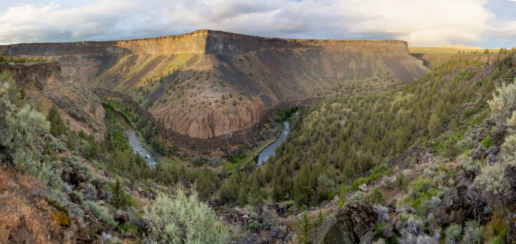
Expanding the U.S. protected area network for our nation’s rivers requires a detailed understanding of where and how rivers are currently being protected. To assist such conservation endeavors, the Changing Landscapes Lab at CSP is partnering with American Rivers to develop new datasets and tools and map the current extent of river protection across the nation. The results of this assessment will enable conservation planners and decision-makers to identify strategic river protection prioritizations and help bend the curve of freshwater biodiversity loss.
Project Description:
Rivers are just a “drop in the bucket” of the water on our planet but support tremendous biodiversity and a large suite of key ecosystem processes, in addition to providing essential cultural and ecosystem services to human societies. Yet, rivers are facing a deepening crisis. To help bend the curve of freshwater biodiversity loss, the Biden’s administration recently committed to protect 30% of U.S. lands and waters by 2030. Achieving this ambitious conservation target requires understanding how and where rivers are currently being protected, and strategically identifying priorities for future protection. But what is the current extent of protection for rivers? This remains unclear as large-scale assessments have predominantly focused on terrestrial and marine systems despite the fact that what confers efficient protection for freshwater biodiversity might differ from other habitats.
Through a partnership with American Rivers, the Changing Landscapes Lab at CSP is assessing the extent of river protection in the U.S. by developing new tools and datasets that consider both the unique spatial structure of rivers and integrate a variety of mechanisms that can confer protection to rivers. This assessment concomitantly considers protection to the main channel of the river itself but also its associated floodplain, as well as the degree of upstream protection conferred by the many federal, state as well as local public and private designations and policies explicitly targeting rivers for protection (e.g., Wild and Scenic Rivers Act, Federal Antidegradation Policy, Riparian Setback Ordinances, Floodplain easements), or incidentally protecting rivers by primarily focusing on the biodiversity value of the surrounding lands (e.g., Wilderness Areas, National Parks, National Wildlife Refuges, State Parks, Conservation Land Easement).
Measuring the extent of river protection is more than of academic interest. The results of this assessment will provide a robust scientific basis to American Rivers and their partners who aim to inform key decision-making to effectively protect, restore, maintain and reduce disparities in accessing and benefiting from healthy waters and the many services supported by rivers. Stakeholder engagement throughout the project will ensure that the knowledge produced will foster bolder policy advocacy and community engagement to expand river protection and reconnect rivers to their floodplains so that local communities can access the myriad of benefits provided by healthy rivers.
Core Partners Include:


Project Highlights
A balanced approach to proactive wildfire management
Integrating social and ecological values in the prioritization of wildfire management can protect critical forest ecosystems and direct resources to the communities that need them most.
Read More
Project Highlights
Evaluating past trends and future trajectories of the sagebrush biome
Geospatial analyses and interactive data visualization approaches are informing proactive conservation planning and better targeting in the sagebrush ecosystem.
Read More
Project Highlights
Protecting ecologically important areas at risk from oil and gas development
Identifying areas where high oil and gas development potential overlaps with key ecological and wildlife values on federal lands helps make the case for their withdrawal from energy development leases
Read More
Project Highlights
Wildlife crossings as a key tool in the climate adaptation toolbox
We are elevating the important role of wildlife crossings in climate adaptation through science synthesis, connectivity modeling, and convening experts to craft actionable guidance for planning and prioritizing future crossings
Read More
Project Highlights
Assessing the current extent of river protection in the U.S.
With a looming freshwater biodiversity crisis and new ambitious conservation goals explicitly targeting inland waters, now is the time to assess gaps in river protection and prioritize conservation strategies for the future.
Read More